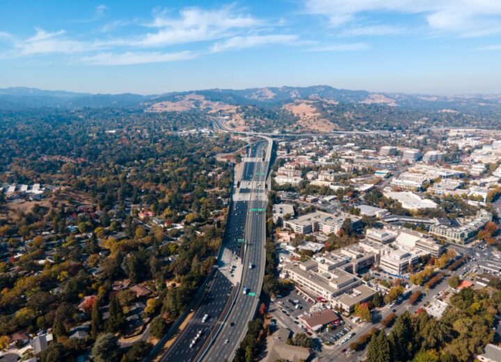
The walnut creek general plan 2050 process is officially underway, and the land-use map that comes out of it will set the rules for every parcel in the city for the next two decades. If you own a multi-family building, a mixed-use property, or a commercial space, the designation on that map determines your allowed uses, your density, and your parking requirements — and those can change before you realize the draft is even public.

What the General Plan Actually Controls
A General Plan is not a zoning code, but it is the document the zoning code must follow. It sets the long-range land-use categories — things like “Medium Density Residential” or “Neighborhood Commercial” — and each one carries assumptions about building height, lot coverage, parking ratios, and permitted activities. When the City Council adopted the resolution to initiate the 2050 General Plan update, it launched a process that will produce a new map, and that map will replace the one that has governed development since the current plan was adopted.
For an owner, the practical question is straightforward: does my parcel stay in the same category, or does it move? A move from one residential designation to another can add or remove the right to build an ADU by right. A move from commercial to mixed-use can open up ground-floor residential, or it can take away a use you have relied on for years. Parking standards shift with the designation too — a category that once required one space per unit might move to a reduced ratio, or to an unbundled parking model that changes how you lease.

The Walnut Creek General Plan 2050 Timeline and What to Watch
The kickoff resolution sets the process in motion, but the draft land-use map is still months away. The city will hold public workshops, circulate environmental documents, and eventually release a draft plan for comment. The window between the draft release and the adoption hearing is when the map is most fluid — and when an owner who shows up with a specific, property-level concern can actually influence the outcome. After adoption, changing a land-use designation requires a General Plan amendment, which is a heavier lift than a zoning change and rarely happens for a single parcel.
What to track:
- The draft land-use map itself, when it appears in a staff report or on the project website.
- The parking standards that accompany each proposed designation — these are often buried in an appendix.
- The allowed-use tables, which define what is permitted by right versus what requires a conditional use permit.
- The environmental impact report, which can flag parcels where a change triggers new requirements under CEQA.
None of this is secret, but it is published in packets that run hundreds of pages, and the labeling is not always obvious. A parcel might be listed by APN, or by a planning-area name that does not match any street address you would recognize. The first read-through usually raises more questions than it answers.
Why This Is Harder Than Checking a Box
Most owners assume the General Plan is a high-level policy document that does not touch their day-to-day operations. That assumption is wrong in one specific way: the land-use map is legally binding, and it changes the baseline for every permit you pull afterward. A property that is re-designated from “General Commercial” to “Mixed-Use Corridor” might lose the ability to renew a use permit for an auto-oriented business, even if the business has been there for years. A residential parcel that moves into a higher-density category might suddenly be subject to inclusionary housing requirements that did not apply before.
The other thing that makes this hard is timing. The draft map will be released, the comment period will open, and the hearings will be scheduled — all on a calendar that the city controls. If you are not watching, you will hear about it after the adoption vote, when your options shrink to a variance or a text amendment. At that point, you are arguing against an adopted policy, and the burden of proof is on you.

What You Can Do Right Now
Pull your property’s current land-use designation and zoning district from the city’s online map. Write them down. Then set a calendar reminder to check the city’s General Plan update page once a month — the draft map will appear there before it appears anywhere else. When it does, compare your parcel’s proposed designation to the current one. If they differ, read the associated standards for parking, density, and permitted uses. That alone puts you ahead of most owners.
If the change looks significant, flag it for a closer review. The draft environmental impact report will tell you whether the re-designation triggers any new mitigation requirements. The staff report will explain the rationale for the change, and that rationale is what you would need to address in a comment letter or at a hearing. The earlier you engage, the more likely it is that a legitimate operational concern — like a parking reduction that makes an existing lease unworkable — gets factored into the final map.
How We Walk Through It With You
When a client asks us to track the walnut creek general plan 2050 process for their property, we start with a parcel-level audit: current designation, current zoning, current uses, and any pending permits or entitlements. We map that against the draft land-use map as soon as it is released, and we produce a one-page summary that flags every delta — what changed, what it means for allowed uses, what it means for parking, and whether it triggers any new obligations.
From there, we build a comment that is specific to the parcel and the operational facts. A comment that says “I oppose the re-designation” carries no weight. A comment that says “This re-designation would reduce the required parking ratio below what the existing lease structure can absorb, and here is the lease schedule to prove it” gives the planning commission something to work with. We handle the submission and the follow-up, and we make sure the hearing date does not slip past unnoticed.
This is not a service that a generic compliance platform can provide. It requires reading the staff reports as they come out, cross-referencing them against the specific parcel, and understanding how the planning process in Walnut Creek actually works. Our real estate services are built for exactly that — property-level operational support that catches the things a calendar reminder cannot.
If your property is in a corridor that the city has already identified for change — like the North Main Street area or the BART station vicinity — the odds of a re-designation are high. We can also look at whether a property management workflow needs to adjust ahead of a parking change, so you are not scrambling when the new standards take effect.
If you want a second set of eyes on your parcel before the draft map drops, reach out through our contact page and we will walk you through what we look for and when.
Have you already checked your parcel’s current land-use designation, or is that still on the to-do list?
About this article. This is general information and our own opinion, written from how we run operations for owners and businesses in Contra Costa County. It is not legal, tax, accounting, financial or other professional advice, it is not a recommendation to take or avoid any action, and it is not a substitute for advice about your own property, tenancy or business. CAO Investment Group is not a law firm, and reading this does not create an attorney-client or any other professional relationship. Local ordinances, fee schedules, forms, thresholds and deadlines change often and differ from city to city within Contra Costa County — anything here may be out of date by the time you read it, including as of the publication date shown above. Verify anything you plan to rely on against the current rules published by your own city or county, and speak to a qualified attorney, CPA or licensed professional about your specific situation before you act. This article refers to material published at this source, which we do not control and which may have changed or been withdrawn since we wrote about it; our description of it is our own reading, not the source speaking. We make no warranty that this information is current, complete or accurate, and we accept no liability for any action taken or not taken on the basis of it.